Bus Nerd noticed this at the southbound Montlake stop the other day.
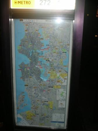
As I said back in August, it’s good for showing which routes go to specific neighborhoods, but because it doesn’t include most streets, I can’t imagine how it would be used practically–without supplementation by Trip Planner or a rider information specialist, that is. For comparison, check out San Fran’s and Vancouver’s system maps. Both are real street maps that also include bus routes. (Also, in both cities, it’s fairly easy to find paper versions of the maps. I don’t know where to find them here.)
For signs at neighborhood stops like the one at Montlake, I’m envisioning the big system map in the background, with the neighborhood in some sort of magnified call-out, a la Google Transit:
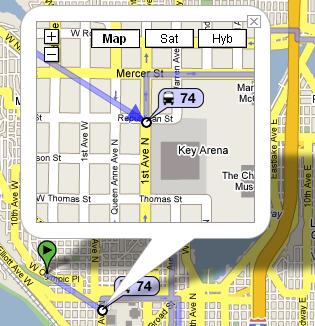
The bus-stop map could include all the streets and routes in the neighborhood.